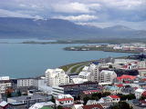
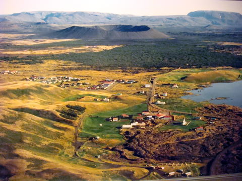
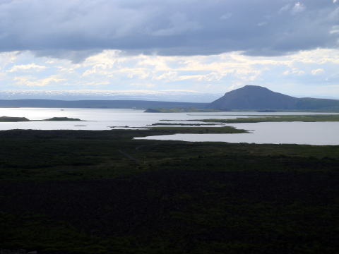
Oxafjordur Bay
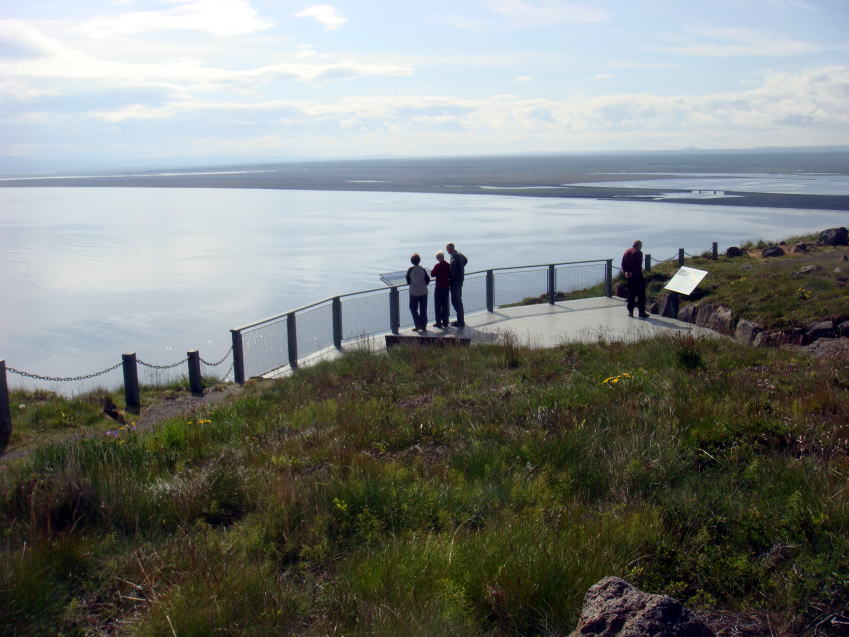
Oxafjordur Bay, Greenland Sea
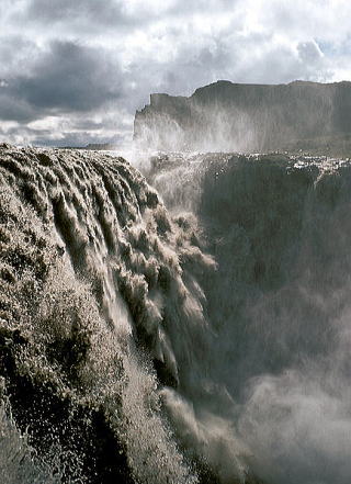
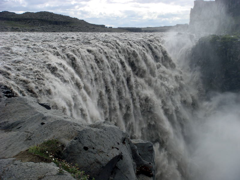
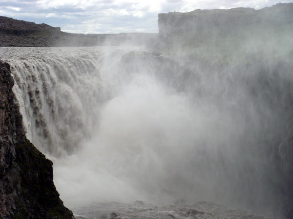
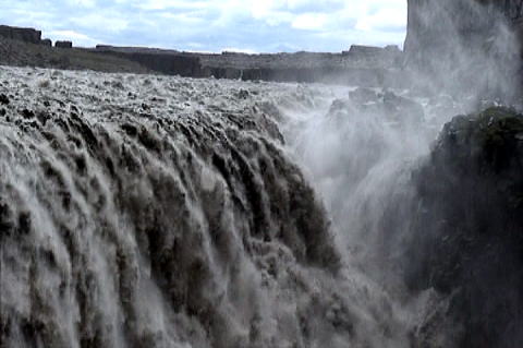
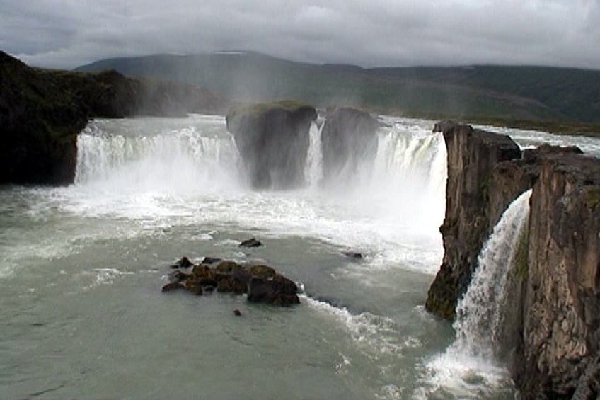
Dettifoss
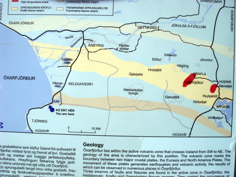 
(L) Map showing Oxafjordur Bay, Dettifoss Fall and Myvatn
(R) Dettifoss photographed by Roger McLassus (uploaded in Wikipedia)
Dettifoss is a waterfall in Jokulsargljufur National Park of Northeast
Iceland. It is situated on the Jokulsa
a Fjollum river, which flows from the Vatnajokull Glacierand collects water
from a large area in Northeast
Iceland. The falls are 100 meters wideand have a drop of 44 meters down to the Jokulsargljutur Canyon.
It is the largestwaterfall in Europe in terms of volume discharge, having
an average water flow of 200
Cubic meter per sec.
Dettifoss
 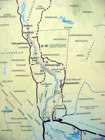
Dettifoss and the route map to Dettifoss
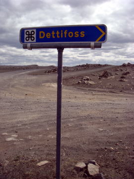 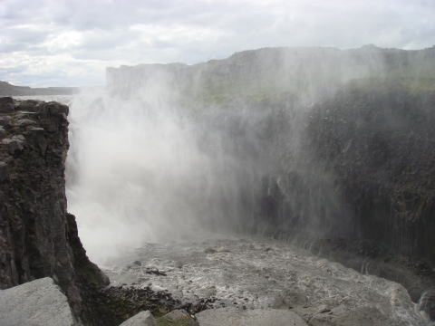 
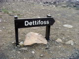
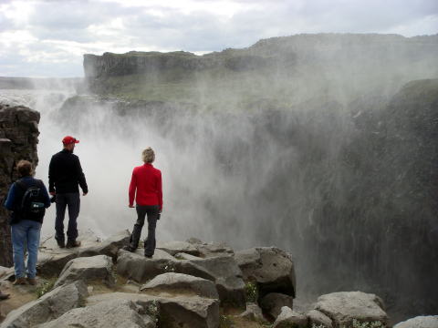
(L)Signpost to Dettifoss (M) Water spray created by Dettifoss falls. (R)
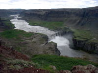
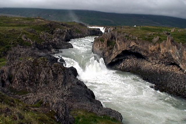
Hafragilsfoss
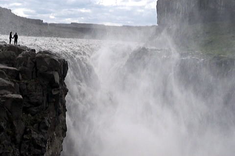 
Dettifoss, giant water falls.
 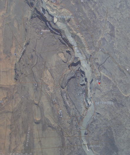
(L) Dettifoss (R) Satellite photo of the area of Dettifoss
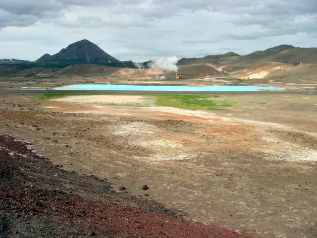
Namafjall, Myvatn and Hverfjall
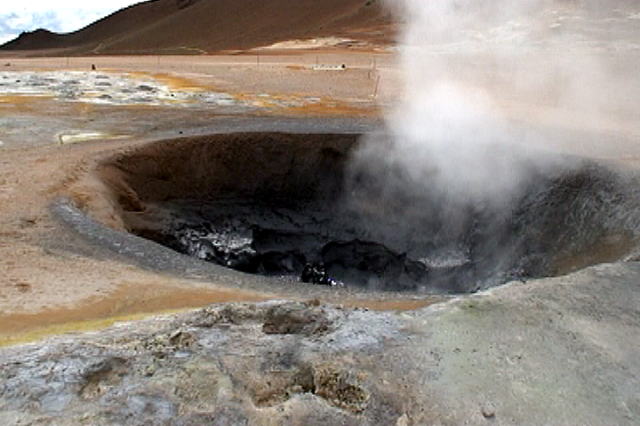 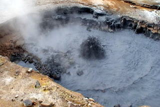
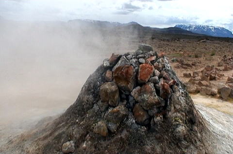
Volcanic activities of Namafjall
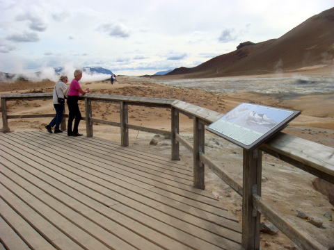 
Observation deck for volcanic activities of Namafjall and Solfatarenveld
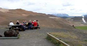 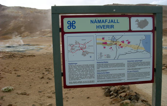
A picnic group and the information signpost of Namafjall near Myvatn, Iceland
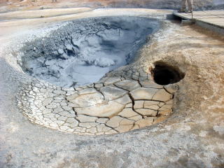 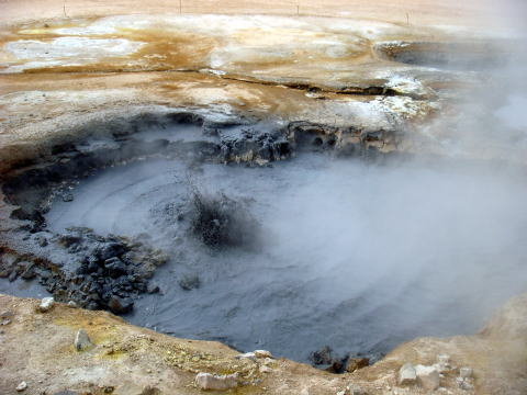
Geothermal mud holes in Namafjall near Myvatn, Iceland
 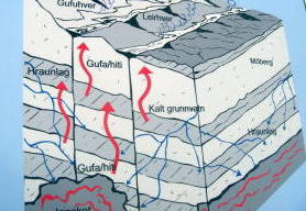
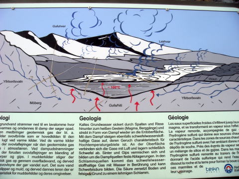
(L) Bjarnarflag, created by volcanic activities.
(R) Cold ground water sweeps down to magma intrusions, where is heated
and transformed into steam,
and then it comes back to the earth surface.
 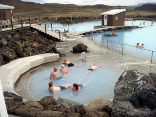
(L) Signpost describing about geology of Myvatn volcano (R) Myvatn Nature
Baths ミ-ヴァトンネイチャーバス
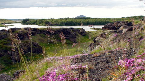
Myvatn is a shallow eutrophic lake situated in an area of active volcanism
in the north of Iceland. The lake
and its wet vicinity have an exceptionally rich fauna of water birds, especially
ducks. The lake was created
by large basaltic lava eruption 2,300 years ago, and the surrounding landscape
is dominated by volcanic
landforms, including lava pillars and pseudo-craters. The name of Myvatnis sometimes used not only for
the lake, but the whole environs inhabited area.
(L) Welcome desk with a charming smile at Hotel Reynihlid, Myvatn
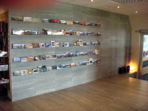
(R) Stone wall with a post card display at the lobby of Hotel Reynihlid
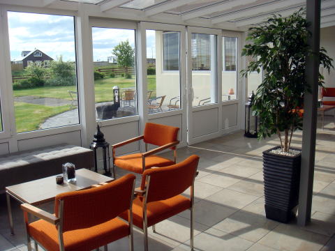 
(L) Sunny room besides the entrance to Hotel Reynihlid (R) Town of Myvatn
and Mount Hverfjall
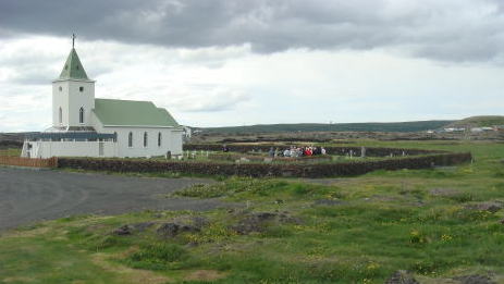 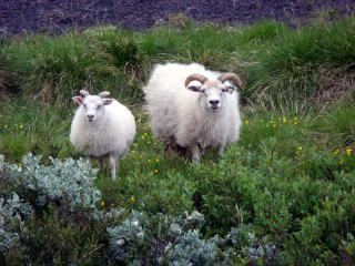
(L) A religious event at Myvatn Church (R) Sheep watching us near the lake
of Myvatn
 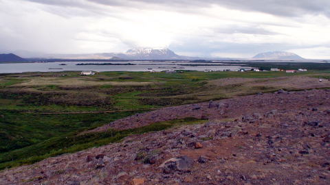
Myvatn, lakes and surrounding area
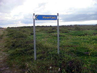 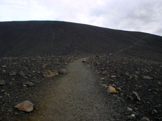
(L) Signpost to Hverfjall (R) Pedestrian walk to the top of Hverfjall crater
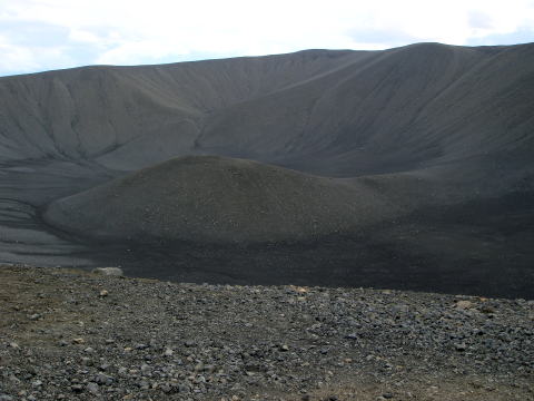 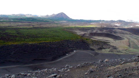
(L) Top of the volcano, Hverfjall (R) Myvatn scenery with craters and mountains
 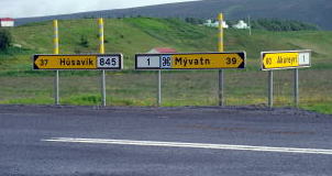
(L) Spectacular view from the top of Mount Hverfjall (R) The point of the
triangle of Husavik, Myvatn and Akureyri
Godafoss
The Godafoss is one of the most spectacular waterfalls in Iceland. It is
located in the north central region
of Iceland, not far from the route 1 highland road. The water of the river of Skjalfandafljot falls from a high
of 12 meters over a width of 30 meters.
Main Falls of Godafoss
 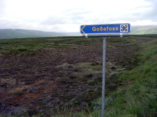
Downstream below Godafoss and the signpost to the fall
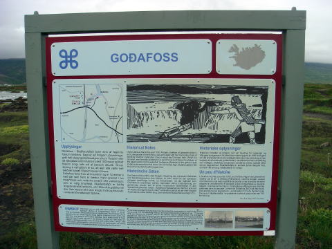 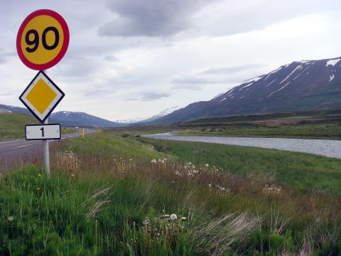
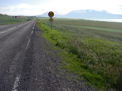
(L) Information board about Godafoss (R) Route 1, a scenic road of Iceland
 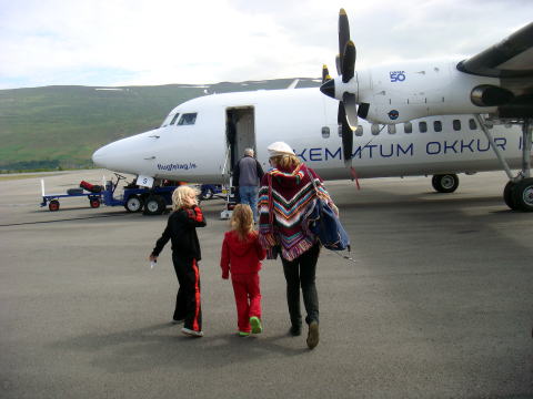
(L) Driving to the town of Akureyri (R) Leaving Akureyri Airport back to
Reikjavik
フーザヴィックからルート85線をチョルネース半島を迂回し、北極圏からの寒流の流れ込む沿岸でグリーンランド
海を望む。今回のアイスランド旅行で最も北の端となった展望台からどこまでも広がる雄大な景色を撮影した。
デティフォス( Dettifoss )は幅、100メートル、落差、44 メートル、毎秒、200 立方メートルの大量の川の水が
一気に流れ落ちる滝である。欧州で最大、最も力強い滝と評価されている。その轟音と流れ下る水流、立ち登る
水しぶきは正に圧巻である。しかし、黒々と混濁した水はまるで悪魔の水のようだ。川の東側と西側とから
アプローチ出来るが、東側の道路はデティフォスより北は悪路となっている。下流には高さ、27 メートルの
ハプラギルスフォス滝(Hafragilsfoss)がある。
アイスランド北東部のミ-ヴァトン( Myvatn ) 湖は溶岩の流れがラクスアゥ ( Laxa )川を堰き止めて出来た。海抜、
277メートル、湖のなかには噴火の結果出来た40を超す小さな島々が点在する。水源は水面下で湧き出ており、
一部分はミ-ヴァトン湖南のグライナヴァトン( Graenavatn ) 湖から流入する。湖水の水深は平均、2mと浅い。
活発な地熱活動により真冬でも完全には凍結しない。世界最大のマリモの群生地でもある。
ナウマフィヤットル (Namafjall )一帯は、他の土地と違い、明るいグレイ・ブラウン色の地形が広がる。泥の池や
硫黄の吹き出し口などが点在し、活発な火山活動を見ることが出来る。「地獄の煙突」との異名を持つ、高さ2m
ほどの火山石の隙間から激しく水蒸気が吹き出している。
2004年に開設されたミ-ヴァトン天然露天風呂はブルーラグーンと同様に地熱で暖められた湯で温泉浴を楽しむ
ようになっている。入場料は大人、2,000 isk.,67歳以上の高齢者は、1,600 isk である。
巨大な丸みを帯びているクヴェルフィヤットル( Hverfjall )山は標高、462メートル、クレータの深さは、
140 メートル、直径、1,000 メートルで、この種のクレータとして世界最大級である。およそ2,500 年前の爆発的
噴火によって出来た。山頂からの360度広がる景観はすばらしい。麓の登山道起点まで車で行ける。
ゴーザフォスは神々の滝の意味で宗教的逸話がある。広大な溶岩台地から満々と水をたたえた川から轟音と共に
流れ落ちる。落差、12m とアイスランドの滝としては小ぶりだが、滝壺の近くに行くと、その迫力に圧倒される。
アイスランド島を環状に走るルート1号線沿線にある。ここからアークレイリまでは風光明媚な道で、快適な
ドライブを楽しむことが出来る。筆者らはこのあと、名残つきないアイスランド北東部地帯に別れを告げ、空路、
レイキャビックに向かう。
Iceland
 Arrival to Reykjavik Blue Lagoon Pingvellir, Strokkur Gullfoss Hekla Skogafoss, Vik Glacia Arrival to Reykjavik Blue Lagoon Pingvellir, Strokkur Gullfoss Hekla Skogafoss, Vik Glacia
Akureyri, Husavik Dettifoss, Myvatn City of Reykjavik
 火山、火山湖、大瀑布 火山、火山湖、大瀑布
 2009年7月執筆 医学博士 宮本順伯 2009年7月執筆 医学博士 宮本順伯
★This Web site is link-free.
This information was provided by the Smokefree Hotel and Travel.
The report was written and photographed in July 2009 by Junhaku Miyamoto,
MD, PhD.
Copyright(C) 2009 Junhaku Miyamoto, All rights reserved.
|